Fire Hazard Map

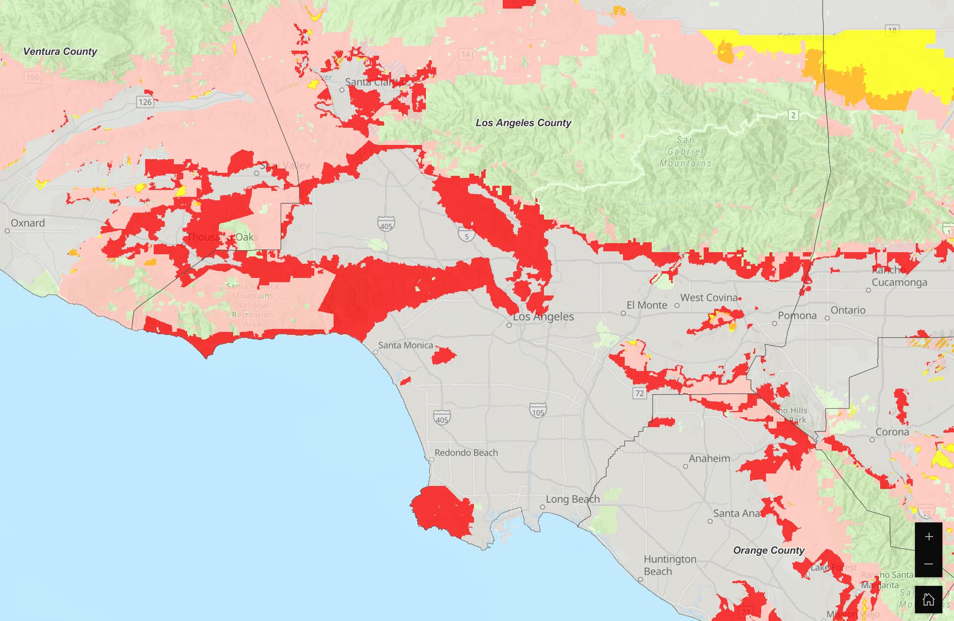
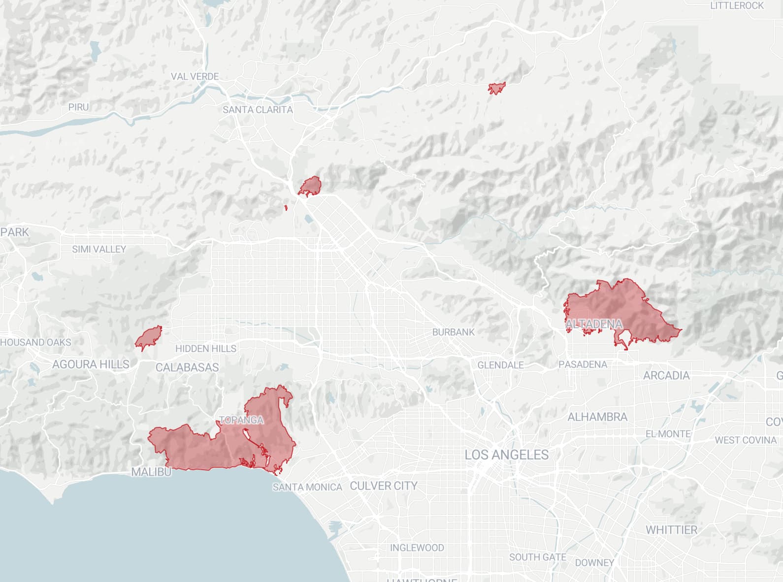
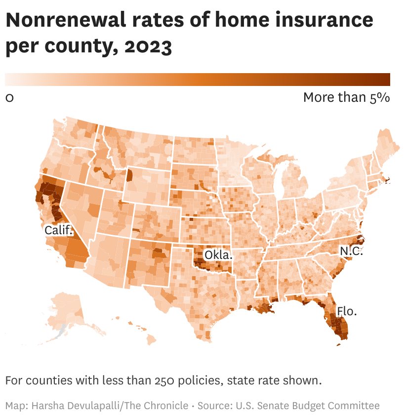
Looks like the worst is likely over with the LA wild fires. I stumbled on this fire hazard map of SoCal. The warning sign has been flashing red for years:

You can see the entire Palisades and the mountain range north of Pasadena in red. Below is the fire map:

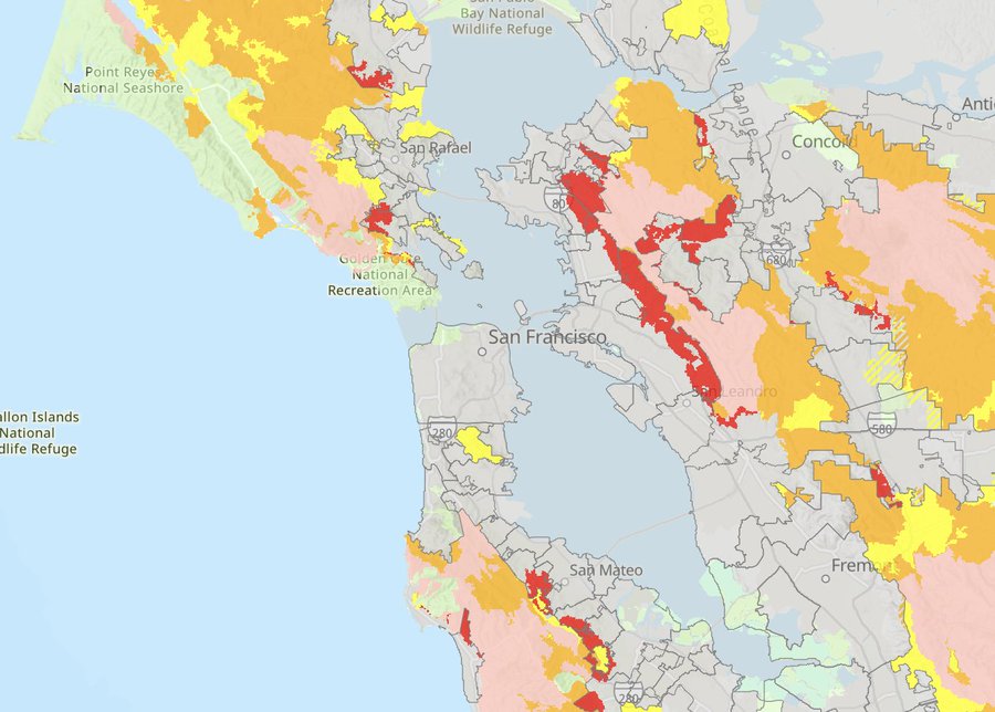
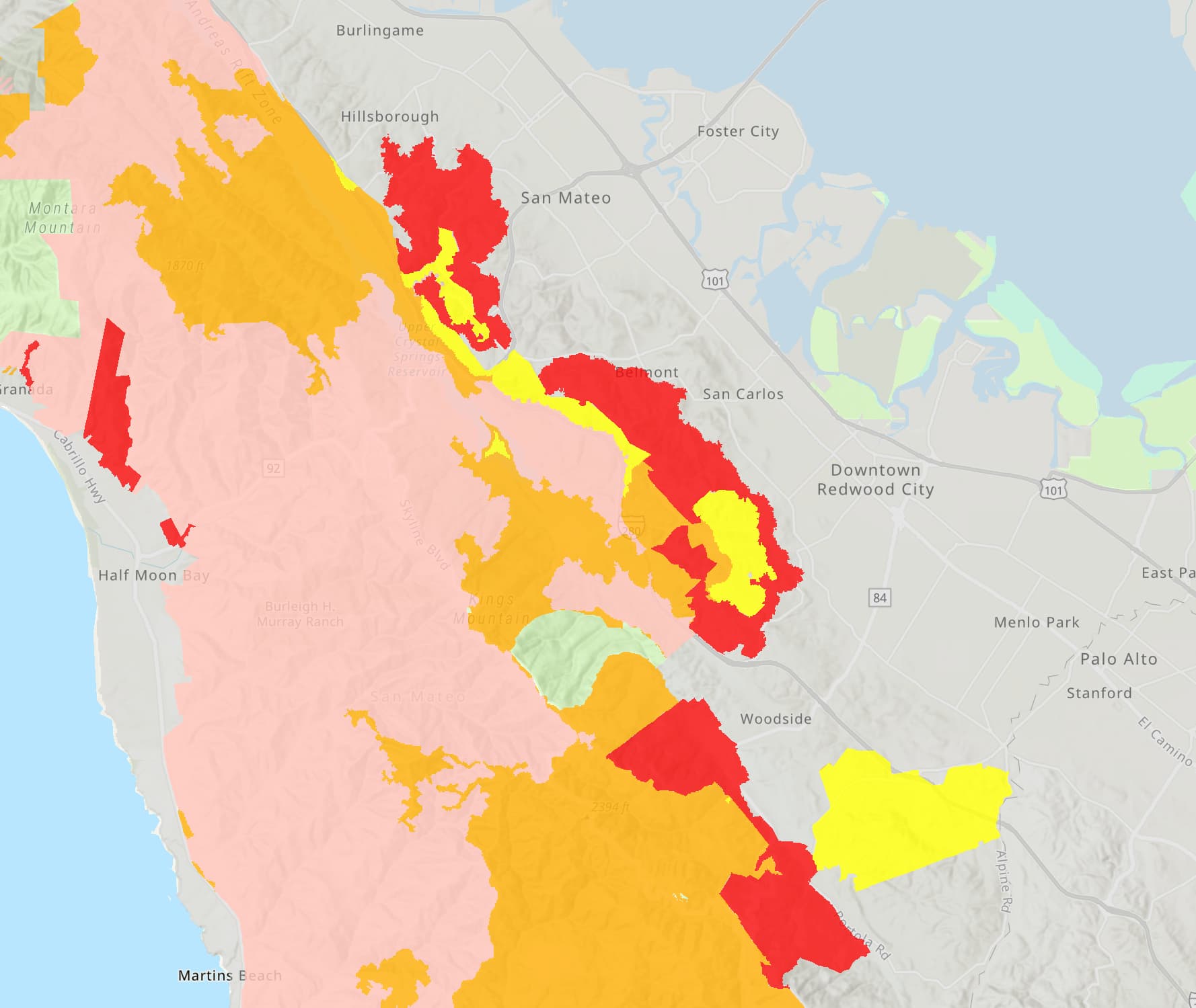
Back to the Bay Area, here is our fire hazard map. Pretty much the entire Oakland hills is in red. The hilly part of Belmont and San Mateo is also in red.

Zoom into the Peninsula:

I suspect the red areas won’t be able to get home insurance in the future, if they somehow can get it now. Here’s the site to get the hazard map:

https://experience.arcgis.com/experience/03beab8511814e79a0e4eabf0d3e7247/

4 Likes

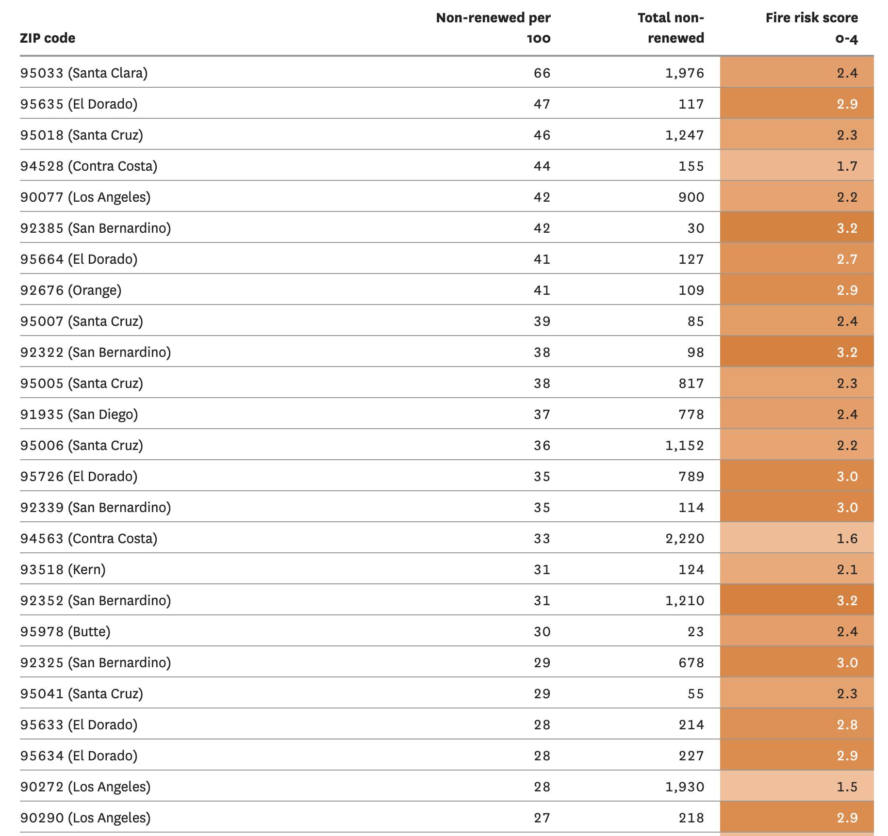
Those maps are based on geography and vegetation type which is all well and good but if your geography is risky you can mitigate the risk. Earthquakes are another risk so you strap or bolt your house to the foundation and take care not to have lots of heavy stuff in our house that is unsecured. Fire is no different. See my comments in the SF thread.

Thanks @manch

The SF Chronicle article actually has a table listing the non-renewal rate in different zip codes.

https://archive.is/PosUE

It’s a huge table. Here’s the top part. The number one on that list is 95033 in Santa Clara County. Lots of areas in Santa Cruz County as well.

1 Like